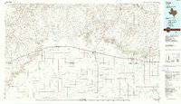
1985 Map of Vega
USGS Topo · Published 1986About this map
Vega serves as the hub of this High Plains landscape, situated along a transportation corridor that includes the Atchison Topeka and Santa Fe railroad. The terrain is defined by the sharp contrast between the flat tablelands and the deeply carved breaks of the Canadian River to the north. A network of intermittent drainages like Alamosa Creek and Sierra de la Cruz Creek cut through the breaks, while the southern plains are dotted with numerous natural depressions such as Bivins Lake and Hay Lake.
Find a feature on this map
54 named features on this map. Tap any name to fly to it.
Don’t see what you’re looking for? This feature index may not catch every label — zoom into the map to look around manually.
Map Details
Editions of this 1985 Vega Map
2 editions found
Other maps of this area

1934 · Ady
USGS Topo · 1:62,500

1934 · Cliffside
USGS Topo · 1:62,500

1936 · Fourways
USGS Topo · 1:62,500

1936 · Cliffside
USGS Topo · 1:62,500

1936 · Ady
USGS Topo · 1:62,500

1953 · Marsh
USGS Topo · 1:24,000

1953 · Puente
USGS Topo · 1:24,000

1953 · Cliffside
USGS Topo · 1:24,000

1954 · Tucumcari
USGS Topo · 1:250,000

1954 · Amarillo
USGS Topo · 1:250,000