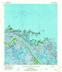
1960 Map of Venice
USGS Topo · Published 1963About this map
The Mississippi River creates a massive alluvial corridor through the marshlands of southern Plaquemines Parish, where the settlements of Triumph, Boothville, and Venice line the narrow levee road. This 1960 era survey highlights the intense maritime and industrial activity at the river's end, marked by numerous docks, a pump house, and the branching waterways of Spanish Pass and Tiger Pass. Beyond the main channel, the landscape dissolves into a complex network of bays such as California Bay and Carencro Bay. To the east, the Delta National Wildlife Refuge preserves the coastal ecosystem near the Grand Bay Oil Field, illustrating the dual character of the region as both a protected wilderness and a hub for energy extraction. Notable landmarks like The Jump and the Boothville Sch provide specific points of reference for local historians and genealogists studying this coastal frontier.
Find a feature on this map
57 named features on this map. Tap any name to fly to it.
Don’t see what you’re looking for? This feature index may not catch every label — zoom into the map to look around manually.
Map Details
Editions of this 1960 Venice Map
3 editions found
Other maps of this area

1892 · Quarantine
USGS Topo · 1:62,500

1893 · East Delta
USGS Topo · 1:62,500

1893 · La Fortuna
USGS Topo · 1:62,500

1893 · Forts
USGS Topo · 1:62,500

1893 · Dime
USGS Topo · 1:62,500

1893 · West Delta
USGS Topo · 1:62,500

1935 · Taylor Pass
USGS Topo · 1:31,680

1935 · Tropical Bend
USGS Topo · 1:31,680

1941 · Black Bay
USGS Topo · 1:62,500

1941 · Empire
USGS Topo · 1:62,500