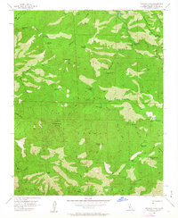
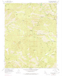
1956 Map of Ventana Cones
USGS Topo · Published 1963About this map
Los Padres National Forest forms the backdrop for this mid-century topographic survey, where high summits and deep canyons dictate the pattern of travel. The landscape is defined by the headwaters of major coastal waterways, including the Big Sur River and the Little Sur River, which carve through the steep terrain of the Santa Lucia Range. Notable peaks such as Ventana Double Cone, featuring a lookout, and South Ventana Cone anchor the topography, while a network of paths like the Pine Ridge Trail and Rattlesnake Trail connect isolated backcountry outposts.
Find a feature on this map
55 named features on this map. Tap any name to fly to it.
Don’t see what you’re looking for? This feature index may not catch every label — zoom into the map to look around manually.
Map Details
Editions of this 1956 Ventana Cones Map
5 editions found
Other maps of this area

1918 · Point Sur
USGS Topo · 1:62,500

1920 · Jamesburg
USGS Topo · 1:48,000

1921 · Jamesburg
USGS Topo · 1:62,500

1921 · Lucia
USGS Topo · 1:62,500

1925 · Point Sur
USGS Topo · 1:62,500

1939 · Jamesburg
USGS Topo · 1:62,500

1940 · Jamesburg
USGS Topo · 1:62,500

1941 · Lucia
USGS Topo · 1:62,500

1947 · Lucia
USGS Topo · 1:62,500

1947 · Jamesburg
USGS Topo · 1:62,500