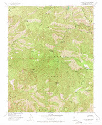
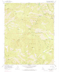
1956 Map of Ventana Cones
USGS Topo · Published 1971About this map
Ventana Double Cone stands as a prominent landmark in the heart of the Los Padres National Forest, marking a landscape defined by the headwaters of several major coastal rivers. This mid-1950s survey documents a network of interior trails and backcountry outposts accessible only by foot or horseback, such as Pat Springs Camp and Sulphur Springs Camp. The drainage patterns are clearly defined, showing the Carmel River flowing northward while the Big Sur River and Little Sur River carve paths through the southern reaches of the quadrangle.
Find a feature on this map
58 named features on this map. Tap any name to fly to it.
Don’t see what you’re looking for? This feature index may not catch every label — zoom into the map to look around manually.
Map Details
Editions of this 1956 Ventana Cones Map
5 editions found
Other maps of this area

1918 · Point Sur
USGS Topo · 1:62,500

1920 · Jamesburg
USGS Topo · 1:48,000

1921 · Jamesburg
USGS Topo · 1:62,500

1921 · Lucia
USGS Topo · 1:62,500

1925 · Point Sur
USGS Topo · 1:62,500

1939 · Jamesburg
USGS Topo · 1:62,500

1940 · Jamesburg
USGS Topo · 1:62,500

1941 · Lucia
USGS Topo · 1:62,500

1947 · Lucia
USGS Topo · 1:62,500

1947 · Jamesburg
USGS Topo · 1:62,500