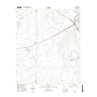
2016 Map of Venus
USGS Topo · Published 2016About this map
The border of Johnson Co and Ellis Co bisects this landscape, where the established grid of the town of Venus meets the industrial and suburban expansion of Midlothian. This mid-2010s survey reveals a terrain defined by significant water management and industrial footprints, notably the Cement Plant Lake and the nearby operations of Ward. These large-scale developments contrast with the traditional rural layout found near Mountain Peak and the legacy of the Newton Cem, which remains a quiet landmark amid the intensifying transport networks of the region.
Find a feature on this map
128 named features on this map. Tap any name to fly to it.
Don’t see what you’re looking for? This feature index may not catch every label — zoom into the map to look around manually.
Map Details
Editions of this 2016 Venus Map
This is the sole edition of this map. No revisions or reprints were ever made.
Other maps of this area

1891 · Dallas
USGS Topo · 1:125,000

1891 · Cleburne
USGS Topo · 1:125,000

1893 · Dallas
USGS Topo · 1:125,000

1894 · Cleburne
USGS Topo · 1:125,000

1894 · Fort Worth
USGS Topo · 1:125,000

1954 · Dallas
USGS Topo · 1:250,000

1958 · Dallas
USGS Topo · 1:250,000

1959 · Cedar Hill
USGS Topo · 1:24,000

1959 · Britton
USGS Topo · 1:24,000

1959 · Mansfield
USGS Topo · 1:24,000