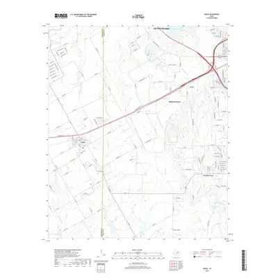
2019 Map of Venus
USGS Topo · Published 2019About this map
Venus serves as a focal point where the Johnson Co and Ellis Co line divides the landscape, showcasing a period of suburban transition in North Texas. The settlement pattern is defined by a grid of streets like Hickory ST and E Henderson ST, transitioning into the rural-industrial corridors leading toward Midlothian and Grand Prairie. The terrain is deeply etched by a network of waterways, including Soap Cr and Cottonwood Cr, which have historically dictated the placement of homesteads and early transport routes. Local history is anchored by landmarks such as the Newton Cem and the small-scale aviation footprint of the Venus Airport. To the southeast, the geography shifts toward the community of Mountain Peak and the waters of Camp Hoblitzelle Lake, illustrating the varied land use between traditional agricultural boundaries and the expanding infrastructure of the Dallas-Fort Worth metroplex.
Find a feature on this map
139 named features on this map. Tap any name to fly to it.
Don’t see what you’re looking for? This feature index may not catch every label — zoom into the map to look around manually.
Map Details
Editions of this 2019 Venus Map
This is the sole edition of this map. No revisions or reprints were ever made.
Other maps of this area

1891 · Dallas
USGS Topo · 1:125,000

1891 · Cleburne
USGS Topo · 1:125,000

1893 · Dallas
USGS Topo · 1:125,000

1894 · Cleburne
USGS Topo · 1:125,000

1894 · Fort Worth
USGS Topo · 1:125,000

1954 · Dallas
USGS Topo · 1:250,000

1958 · Dallas
USGS Topo · 1:250,000

1959 · Cedar Hill
USGS Topo · 1:24,000

1959 · Britton
USGS Topo · 1:24,000

1959 · Mansfield
USGS Topo · 1:24,000