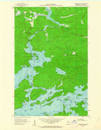
1956 Map of Vermilion Dam
USGS Topo · Published 1963About this map
Lake Vermilion and its intricate northern shoreline dominate this mid-century survey, revealing a landscape defined by water and woods. The infrastructure of the Vermilion River is carefully documented, featuring the Gaging Station and the Vermilion Dam Lookout Tower, which served as critical points for forestry and water management during the 1950s. The map illustrates a complex network of bays and channels, including Kabetogama Bay and Wolf Bay, separated by islands like Knotts Island and Hinsdale Island.
Find a feature on this map
29 named features on this map. Tap any name to fly to it.
Don’t see what you’re looking for? This feature index may not catch every label — zoom into the map to look around manually.
Map Details
Editions of this 1956 Vermilion Dam Map
5 editions found
Other maps of this area

1954 · Hibbing
USGS Topo · 1:250,000

1954 · International Falls
USGS Topo · 1:250,000

1956 · Sioux Pine Island
USGS Topo · 1:24,000

1956 · Tower
USGS Topo · 1:24,000

1956 · Vermilion Dam
USGS Topo · 1:24,000

1956 · Lost Lake
USGS Topo · 1:24,000

1957 · Hibbing
USGS Topo · 1:250,000

1957 · International Falls
USGS Topo · 1:250,000

1958 · International Falls
USGS Topo · 1:250,000

1958 · Hibbing
USGS Topo · 1:250,000