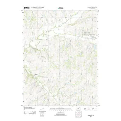
2012 Map of Vermillion
USGS Topo · Published 2012About this map
Black Vermillion River and its numerous tributaries, including the N Fork Black Vermillion River, carve through this section of Marshall County. The town of Vermillion serves as a central hub, characterized by a grid of streets such as Main St and 3rd St, while the small settlement of Vliets lies to the west near the Morrison Cem. This 2012 survey illustrates a landscape primarily defined by section-line roads like Zenith Rd and Ridge Rd, reflecting the enduring agricultural geometry of the Kansas plains. Genealogists may find value in the locations of the Vermillion Cem and the small Sullivan settlement, while the network of creeks like Ackerman Cr and Irish Cr shows the drainage patterns critical to the local farming economy.
Find a feature on this map
39 named features on this map. Tap any name to fly to it.
Don’t see what you’re looking for? This feature index may not catch every label — zoom into the map to look around manually.
Map Details
Editions of this 2012 Vermillion Map
This is the sole edition of this map. No revisions or reprints were ever made.
Other maps of this area

1889 · Seneca
USGS Topo · 1:125,000

1894 · Seneca
USGS Topo · 1:125,000

1955 · Manhattan
USGS Topo · 1:250,000

1956 · Manhattan
USGS Topo · 1:250,000

1957 · Manhattan
USGS Topo · 1:250,000

1966 · Baileyville
USGS Topo · 1:24,000

1966 · Axtell
USGS Topo · 1:24,000
1966 · Beattie
USGS Topo · 1:24,000
1969 · Centralia
USGS Topo · 1:24,000
1969 · Frankfort
USGS Topo · 1:24,000