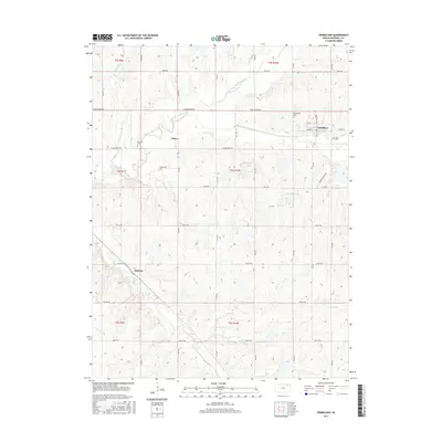
2015 Map of Vermillion
USGS Topo · Published 2015About this map
The town of Vermillion anchors the northeastern corner of this Marshall County survey, where the valley of the Black Vermillion River cuts through the landscape. Agriculture and rural life define the area, evidenced by the grid of local roads such as Sunflower Rd and Tumbleweed Rd that connect smaller settlements like Vliets and Sullivan. Local history and genealogy are preserved at the Morrison Cem and Vermillion Cem, which sit alongside established drainage basins like Ackerman Cr and Irish Creek. The land is divided into several townships including t4s r10e, showing a persistent pattern of rural property boundaries. This landscape reflects the enduring settlement patterns of northeast Kansas, where watercourses like Kearney Br dictated the placement of roads and homesteads.
Find a feature on this map
30 named features on this map. Tap any name to fly to it.
Don’t see what you’re looking for? This feature index may not catch every label — zoom into the map to look around manually.
Map Details
Editions of this 2015 Vermillion Map
This is the sole edition of this map. No revisions or reprints were ever made.
Other maps of this area

1889 · Seneca
USGS Topo · 1:125,000

1894 · Seneca
USGS Topo · 1:125,000

1955 · Manhattan
USGS Topo · 1:250,000

1956 · Manhattan
USGS Topo · 1:250,000

1957 · Manhattan
USGS Topo · 1:250,000

1966 · Baileyville
USGS Topo · 1:24,000

1966 · Axtell
USGS Topo · 1:24,000
1966 · Beattie
USGS Topo · 1:24,000
1969 · Centralia
USGS Topo · 1:24,000
1969 · Frankfort
USGS Topo · 1:24,000