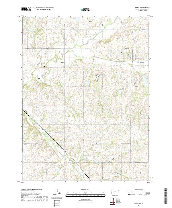
2022 Map of Vermillion
USGS Topo · Published 2022About this map
The Black Vermillion River and its various tributaries, including the N Fork Black Vermillion River and Irish Creek, define the topography of this Marshall County landscape. The town of Vermillion sits near the eastern edge of the survey, where a residential grid meets the surrounding farm roads. Further west, the smaller settlement of Vliets is positioned near the riverbank, while the locality of Sullivan is situated to the southwest. The area is characterized by a dense network of sectional roads such as Sunflower Rd and Ridge Rd that cross over smaller waterways like Ackerman Cr and Kearney Br. Genealogists may find particular value in the presence of Vermillion Cem and the more isolated Morrison Cem, which mark the historical burial grounds for these rural Kansas communities.
Find a feature on this map
42 named features on this map. Tap any name to fly to it.
Don’t see what you’re looking for? This feature index may not catch every label — zoom into the map to look around manually.
Map Details
Editions of this 2022 Vermillion Map
This is the sole edition of this map. No revisions or reprints were ever made.
Other maps of this area

1889 · Seneca
USGS Topo · 1:125,000

1894 · Seneca
USGS Topo · 1:125,000

1955 · Manhattan
USGS Topo · 1:250,000

1956 · Manhattan
USGS Topo · 1:250,000

1957 · Manhattan
USGS Topo · 1:250,000

1966 · Baileyville
USGS Topo · 1:24,000

1966 · Axtell
USGS Topo · 1:24,000
1966 · Beattie
USGS Topo · 1:24,000
1969 · Centralia
USGS Topo · 1:24,000
1969 · Frankfort
USGS Topo · 1:24,000