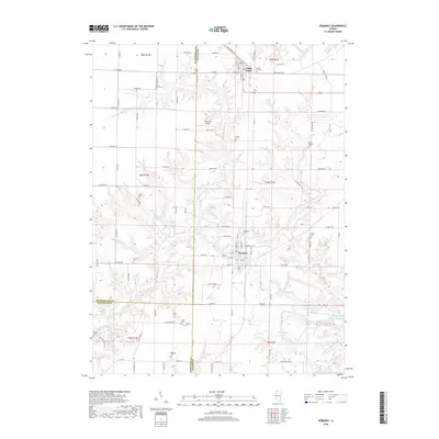
2018 Map of Vermont
USGS Topo · Published 2018About this map
The village of Vermont anchors this survey at the intersection of Fulton, McDonough, and Schuyler Counties. This West Central Illinois landscape is characterized by a dense distribution of rural burial grounds, including the Vermont Cem, Harris Cem, and Laurel Hill Cem near the neighboring community of Table Grove. The terrain is defined by the drainage basins of Sugar Cr and Otter Cr, where the topography breaks into wooded ravines and small water bodies like Vermont New-Lake and Freshwater Lake. For family historians, the map's preservation of family-named landmarks such as Foster Point Cem and Miles Cem offers precise locations for ancestral research. The presence of Richmond Airport and a grid of rural routes like Quarter Rd and Bailey Rd illustrate the modern transportation network laid over the traditional 1:24,000 scale Public Land Survey System sections.
Find a feature on this map
77 named features on this map. Tap any name to fly to it.
Don’t see what you’re looking for? This feature index may not catch every label — zoom into the map to look around manually.
Map Details
Editions of this 2018 Vermont Map
This is the sole edition of this map. No revisions or reprints were ever made.
Other maps of this area

1912 · Macomb
USGS Topo · 1:62,500

1914 · Macomb
USGS Topo · 1:62,500

1918 · Vermont
USGS Topo · 1:62,500

1921 · Vermont
USGS Topo · 1:62,500

1923 · Rushville
USGS Topo · 1:62,500

1926 · Beardstown
USGS Topo · 1:62,500

1926 · Rushville
USGS Topo · 1:62,500

1944 · Beardstown
USGS Topo · 1:62,500

1947 · Vermont
USGS Topo · 1:24,000

1947 · Adair
USGS Topo · 1:24,000