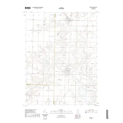
2021 Map of Vermont
USGS Topo · Published 2021About this map
The village of Vermont and the neighboring community of Table Grove anchor this western Illinois landscape at the intersection of Fulton, McDonough, and Schuyler counties. The terrain is defined by the dendritic drainage patterns of Sugar Cr and Otter Cr, which have carved deep valleys into the surrounding agricultural uplands. This 2021 survey reveals a high concentration of small family and community burial grounds, such as Foster Point Cem and Harris Cem, which are often found on elevated ground overlooking the creek bottoms. The presence of Richmond Airport north of Vermont and Vermont New Lake to the west indicates more modern developments in land use, yet the underlying grid of rural routes like Co RD 600 N and Quarter Rd maintains the traditional township structure that has organized this region for generations.
Find a feature on this map
92 named features on this map. Tap any name to fly to it.
Don’t see what you’re looking for? This feature index may not catch every label — zoom into the map to look around manually.
Map Details
Editions of this 2021 Vermont Map
This is the sole edition of this map. No revisions or reprints were ever made.
Other maps of this area

1912 · Macomb
USGS Topo · 1:62,500

1914 · Macomb
USGS Topo · 1:62,500

1918 · Vermont
USGS Topo · 1:62,500

1921 · Vermont
USGS Topo · 1:62,500

1923 · Rushville
USGS Topo · 1:62,500

1926 · Beardstown
USGS Topo · 1:62,500

1926 · Rushville
USGS Topo · 1:62,500

1944 · Beardstown
USGS Topo · 1:62,500

1947 · Vermont
USGS Topo · 1:24,000

1947 · Adair
USGS Topo · 1:24,000