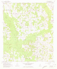
1962 Map of Vernon
USGS Topo · Published 1981About this map
The ancient Nanih Waiya Indian Mound serves as a cultural anchor for this portion of the Winston and Neshoba County line. Surveyed in the early 1960s, the landscape is defined by the convergence of several major waterways, including Big Tallahaga Creek, Bogue Chitto Creek, and Nanih Waiya Creek. The rural community structure centers on small settlements like Vernon and Claytown, where daily life was organized around local institutions such as the Nanih Waiya Sch and Harmony Ch.
Find a feature on this map
34 named features on this map. Tap any name to fly to it.
Don’t see what you’re looking for? This feature index may not catch every label — zoom into the map to look around manually.
Map Details
Editions of this 1962 Vernon Map
3 editions found
Other maps of this area

1953 · Meridian
USGS Topo · 1:250,000

1953 · West Point
USGS Topo · 1:250,000

1957 · Meridian
USGS Topo · 1:250,000

1958 · West Point
USGS Topo · 1:250,000

1962 · Lynville
USGS Topo · 1:24,000

1962 · Vernon
USGS Topo · 1:24,000

1962 · Owl Creek
USGS Topo · 1:24,000

1962 · Preston
USGS Topo · 1:24,000

1963 · West Point
USGS Topo · 1:250,000

1965 · Meridian
USGS Topo · 1:250,000