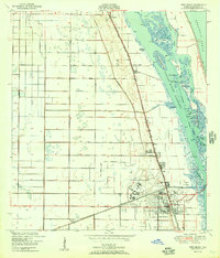
1950 Map of Vero Beach
USGS Topo · Published 1950About this map
The Indian River Narrows and the Atlantic Ocean define this coastal landscape just after the mid-century, showcasing a period of significant development along Florida's Atlantic shoreline. The rail-oriented growth of Vero Beach is clear, with the Florida East Coast railroad serving as the primary north-south spine connecting the communities of Wabasso, Winter Beach, and Gifford. To the west of the central settlements, a network of agricultural drainage canals, including the North Canal and Main Canal, cuts through the terrain, illustrating the era's intensive efforts to reclaim land for citrus and farming.
Find a feature on this map
42 named features on this map. Tap any name to fly to it.
Don’t see what you’re looking for? This feature index may not catch every label — zoom into the map to look around manually.
Map Details
Editions of this 1950 Vero Beach Map
2 editions found
Other maps of this area

1948 · Riomar
USGS Topo · 1:24,000

1948 · Indrio
USGS Topo · 1:24,000

1949 · Fellsmere
USGS Topo · 1:24,000

1949 · Vero Beach
USGS Topo · 1:24,000

1949 · Sebastian
USGS Topo · 1:24,000

1949 · Oslo
USGS Topo · 1:24,000

1950 · Riomar
USGS Topo · 1:24,000

1950 · Oslo
USGS Topo · 1:24,000

1950 · Indrio
USGS Topo · 1:24,000

1950 · Vero Beach
USGS Topo · 1:24,000