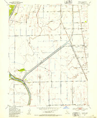
1952 Map of Verona
USGS Topo · Published 1953About this map
The Feather River and Sacramento River converge in this low-lying landscape, where the Sutter By-Pass and a series of levees define the flood-prone agricultural terrain. This 1952 survey details a region shaped by water management and river traffic, highlighting the American Basin and the early riverboat hubs at Fremont Landing and Vernon Landing. The map illustrates the heavy reliance on irrigation and drainage, visible through the extensive network of the Main Canal and Cross Canal.
Find a feature on this map
32 named features on this map. Tap any name to fly to it.
Don’t see what you’re looking for? This feature index may not catch every label — zoom into the map to look around manually.
Map Details
Editions of this 1952 Verona Map
3 editions found
Other maps of this area

1891 · Sacramento
USGS Topo · 1:125,000

1892 · Sacramento
USGS Topo · 1:125,000

1893 · Sacramento
USGS Topo · 1:125,000

1902 · Fairoaks
USGS Topo · 1:62,500

1907 · Davisville
USGS Topo · 1:62,500

1910 · Sheridan
USGS Topo · 1:31,680

1910 · Knights Landing
USGS Topo · 1:31,680

1910 · Vernon
USGS Topo · 1:31,680

1910 · Nicolaus
USGS Topo · 1:31,680

1910 · Pleasant Grove
USGS Topo · 1:31,680