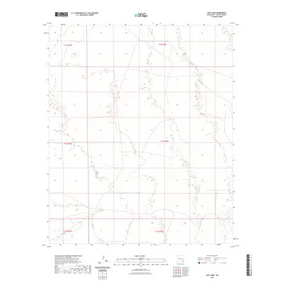
2023 Map of Vest Camp
USGS Topo · Published 2023About this map
Chaves County's arid high plains are defined by the Public Land Survey System grid, which imposes a geometric order over this segment of New Mexico's desert landscape. The terrain is marked by township and range boundaries, including t13s r29e, which organize the vast open spaces between sparse infrastructure. Human activity is largely represented by the transit corridors of Co Rd 161 and Co Rd 165, which navigate the contours of the basin floor. This modern survey illustrates the enduring reliance on these section lines for land management and navigation in an environment where natural landmarks are few and the cattle-ranching legacy of the region persists through the maintained road network and land divisions.
Find a feature on this map
8 named features on this map. Tap any name to fly to it.
Don’t see what you’re looking for? This feature index may not catch every label — zoom into the map to look around manually.
Map Details
Editions of this 2023 Vest Camp Map
This is the sole edition of this map. No revisions or reprints were ever made.
Other maps of this area

1949 · Malstrom Ranch
USGS Topo · 1:24,000

1951 · King Camp
USGS Topo · 1:24,000

1952 · Connor Well
USGS Topo · 1:24,000

1954 · Brownfield
USGS Topo · 1:250,000

1955 · Roswell
USGS Topo · 1:250,000

1958 · Brownfield
USGS Topo · 1:250,000

1958 · Roswell
USGS Topo · 1:250,000

1962 · Roswell
USGS Topo · 1:250,000

1962 · Brownfield
USGS Topo · 1:250,000

1973 · Culp Ranch
USGS Topo · 1:24,000