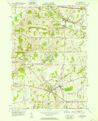
1951 Map of Victor
USGS Topo · Published 1952About this map
The village of Victor serves as a focal point for this early 1950s survey of Ontario County, where the industrial and agricultural landscape of Western New York is clearly defined. The mapping shows a significant transit corridor dominated by the Lehigh Valley Railroad and the New York Central Railroad, which parallel the newly developing New York State Thruway. To the south, the twin settlements of East Bloomfield and Holcomb anchor the rural landscape, connected by a network of country roads including Gauss Road and Rice Road.
Find a feature on this map
43 named features on this map. Tap any name to fly to it.
Don’t see what you’re looking for? This feature index may not catch every label — zoom into the map to look around manually.
Map Details
Editions of this 1951 Victor Map
3 editions found
Other maps of this area

1895 · Rochester
USGS Topo · 1:62,500

1898 · Rochester
USGS Topo · 1:62,500

1900 · Macedon
USGS Topo · 1:62,500

1900 · Canandaigua
USGS Topo · 1:62,500

1901 · Honeoye
USGS Topo · 1:62,500

1903 · Canandaigua
USGS Topo · 1:62,500

1904 · Honeoye
USGS Topo · 1:62,500

1912 · Rochester
USGS Topo · 1:62,500

1920 · Rochester
USGS Topo · 1:62,500

1931 · Mendon Ponds
USGS Topo · 1:24,000