2022 Map of Victoria
USGS Topo · Published 2022About this map
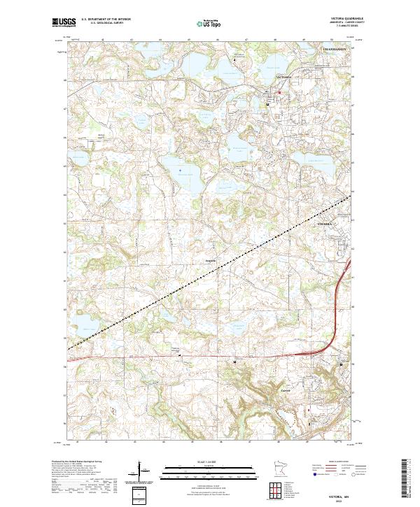
Victoria sits at the heart of this landscape, surrounded by an intricate network of glacial lakes and wetlands in eastern Carver County. In the early 2020s, this area reflects a mixture of growing suburban developments and deep-rooted rural sites. Historically significant landmarks include the Saint Victoria Cem and the Lake Auburn Moravian Cem near Lake Auburn, pointing to the region's diverse congregational heritage. The terrain is defined by water bodies like Wassermann Lake, Lake Bavaria, and Piersons Lake, which are interconnected by drainages such as Sixmile Creek. To the south, the village of Augusta and the city of Carver appear near the winding path of Carver Cr, while the northeastern corner shows the expansion of Chanhassen and Chaska. Transportation is anchored by Arboretum Blvd, providing access to local hubs and the aviation facilities at Molnau Airpark.
Find a feature on this map
137 named features on this map. Tap any name to fly to it.
Don’t see what you’re looking for? This feature index may not catch every label — zoom into the map to look around manually.
Map Details
Editions of this 2022 Victoria Map
This is the sole edition of this map. No revisions or reprints were ever made.