
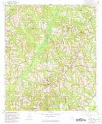
1960 Map of Victoria
USGS Topo · Published 1963About this map
Victoria serves as the focal point of this rural landscape where the northern edge of Coffee County meets Pike County. The geography is defined by a dense network of watercourses, most notably the wide, marshy expanse of Whitewater Creek as it flows south toward its confluence with the Pea River at the bottom of the sheet. This environment supported a scattered agricultural community connected by winding local roads that converged at points like Clowers Crossroads or the settlement of Jack.
Find a feature on this map
17 named features on this map. Tap any name to fly to it.
Don’t see what you’re looking for? This feature index may not catch every label — zoom into the map to look around manually.
Map Details
Editions of this 1960 Victoria Map
2 editions found
Other maps of this area

1942 · Enterprise
USGS Topo · 1:125,000

1948 · Brundidge
USGS Topo · 1:62,500

1950 · Enterprise
USGS Topo · 1:62,500

1950 · Brundidge
USGS Topo · 1:62,500

1953 · Andalusia
USGS Topo · 1:250,000

1953 · Dothan
USGS Topo · 1:250,000

1954 · Dothan
USGS Topo · 1:250,000

1955 · Dothan
USGS Topo · 1:250,000

1957 · Andalusia
USGS Topo · 1:250,000

1960 · Brundidge
USGS Topo · 1:24,000