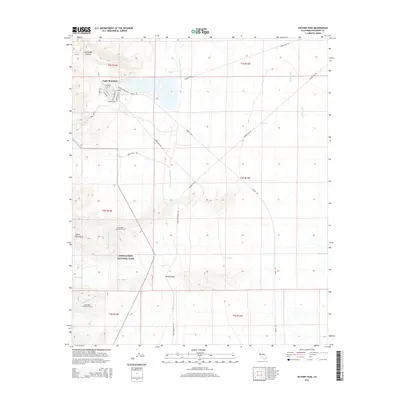
2015 Map of Victory Pass
USGS Topo · Published 2015About this map
Eagle Mountain serves as the focal point of this arid Riverside County landscape, where the residential street grid of the mining community meets the eastern boundary of Joshua Tree National Park. The map documents a critical intersection of infrastructure and desert terrain, dominated by the massive Colorado River Aqueduct as it traverses the Eagle Mountains. This engineering feat is marked by the West Eagle Mountain Tunnel and East Eagle Mountain Tunnel, which channel water beneath the high ridges. The surrounding basin is defined by wide ephemeral drainage systems like Big Wash and Pinto Wash, which flow toward Victory Pass. The presence of the Kaiser Truck Route and Kaiser Rd reflects the area's twentieth-century industrial legacy, supporting operations near the edge of the protected wilderness.
Find a feature on this map
32 named features on this map. Tap any name to fly to it.
Don’t see what you’re looking for? This feature index may not catch every label — zoom into the map to look around manually.
Map Details
Editions of this 2015 Victory Pass Map
This is the sole edition of this map. No revisions or reprints were ever made.
Other maps of this area

1940 · Canyon Spring
USGS Topo · 1:62,500

1943 · Canyon Spring
USGS Topo · 1:62,500

1943 · Coxcomb Mountains
USGS Topo · 1:62,500

1944 · Eagle Tank
USGS Topo · 1:62,500

1944 · Chuckwalla Mountains
USGS Topo · 1:62,500

1944 · Coxcomb Mountains
USGS Topo · 1:62,500

1954 · Salton Sea
USGS Topo · 1:250,000

1955 · Salton Sea
USGS Topo · 1:250,000

1959 · Salton Sea
USGS Topo · 1:250,000

1963 · Salton Sea
USGS Topo · 1:250,000