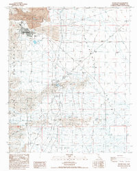
1987 Map of Victory Pass
USGS Topo · Published 1987About this map
The Eagle Mountain Mine dominates the northern reaches of this desert landscape, revealing a massive industrial footprint carved into the Eagle Mountains. The adjacent settlement of Eagle Mountain is documented with its residential blocks and the Eagle Mountain Sch, serving the workforce of the iron ore operation. Infrastructure tailored to this arid environment is prominent, including the Eagle Mountain Pumping Plant, a Landing Strip, and specialized water management features like the Silt Trap and Sewage Disposal Ponds.
Find a feature on this map
25 named features on this map. Tap any name to fly to it.
Don’t see what you’re looking for? This feature index may not catch every label — zoom into the map to look around manually.
Map Details
Editions of this 1987 Victory Pass Map
This is the sole edition of this map. No revisions or reprints were ever made.
Other maps of this area

1940 · Canyon Spring
USGS Topo · 1:62,500

1943 · Canyon Spring
USGS Topo · 1:62,500

1943 · Coxcomb Mountains
USGS Topo · 1:62,500

1944 · Eagle Tank
USGS Topo · 1:62,500

1944 · Chuckwalla Mountains
USGS Topo · 1:62,500

1944 · Coxcomb Mountains
USGS Topo · 1:62,500

1954 · Salton Sea
USGS Topo · 1:250,000

1955 · Salton Sea
USGS Topo · 1:250,000

1959 · Salton Sea
USGS Topo · 1:250,000

1963 · Salton Sea
USGS Topo · 1:250,000