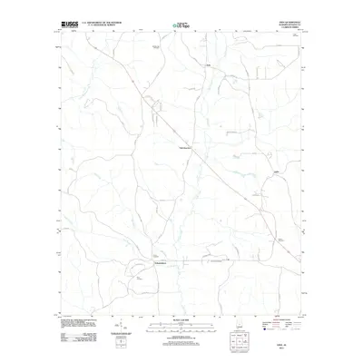
2011 Map of Vida
USGS Topo · Published 2011About this map
Independence and the rural crossroads of Vida anchor this portion of Autauga County, where a network of family cemeteries and winding waterways defines the landscape. The terrain is deeply carved by drainage systems including Swift Creek and Mill Creek, which flow southward through a series of ridges and valleys. Genealogists will find a high concentration of burial grounds such as Big Springs Cemetery, Carter Cemetery, and Deramus Cemetery scattered across the countryside, often located near established farm roads and family-named landmarks like Barrett Hill Ln.
Find a feature on this map
57 named features on this map. Tap any name to fly to it.
Don’t see what you’re looking for? This feature index may not catch every label — zoom into the map to look around manually.
Map Details
Editions of this 2011 Vida Map
This is the sole edition of this map. No revisions or reprints were ever made.
Other maps of this area

1891 · Clanton
USGS Topo · 1:125,000

1953 · Montgomery
USGS Topo · 1:250,000

1956 · Montgomery
USGS Topo · 1:250,000

1957 · Montgomery
USGS Topo · 1:250,000

1957 · Autaugaville
USGS Topo · 1:62,500

1957 · Benton
USGS Topo · 1:62,500

1959 · Plantersville
USGS Topo · 1:62,500

1959 · Billingsley
USGS Topo · 1:62,500

1975 · Plantersville SE
USGS Topo · 1:24,000
1975 · Benton NE
USGS Topo · 1:24,000