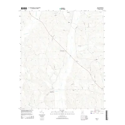
2014 Map of Vida
USGS Topo · Published 2014About this map
Haynes and Vida anchor the northern reaches of this Autauga County landscape, where the primary corridor of Us-82 cuts diagonally across a terrain defined by shifting creek beds and small rural clusters. The map reveals a high concentration of ancestral burial grounds, including the Big Springs Cem near the northern boundary and the King Cem further south near Independence. These locations, alongside the Jones Cem and Deramus Cem, provide critical touchpoints for family historians tracing the early settlement patterns of this Alabama interior.
Find a feature on this map
53 named features on this map. Tap any name to fly to it.
Don’t see what you’re looking for? This feature index may not catch every label — zoom into the map to look around manually.
Map Details
Editions of this 2014 Vida Map
This is the sole edition of this map. No revisions or reprints were ever made.
Other maps of this area

1891 · Clanton
USGS Topo · 1:125,000

1953 · Montgomery
USGS Topo · 1:250,000

1956 · Montgomery
USGS Topo · 1:250,000

1957 · Montgomery
USGS Topo · 1:250,000

1957 · Autaugaville
USGS Topo · 1:62,500

1957 · Benton
USGS Topo · 1:62,500

1959 · Plantersville
USGS Topo · 1:62,500

1959 · Billingsley
USGS Topo · 1:62,500

1975 · Plantersville SE
USGS Topo · 1:24,000
1975 · Benton NE
USGS Topo · 1:24,000