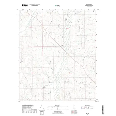
2018 Map of Vida
USGS Topo · Published 2018About this map
Independence and Vida Junction serve as central nodes for the agricultural and rural community of north-central Autauga County in this 2018 survey. The landscape is defined by the dendritic drainage of Swift Cr and Little Mulberry Cr, where the terrain's subtle elevation changes influenced the placement of longstanding family-named cemeteries and crossroads. For genealogists, the map preserves the exact locations of burial grounds such as Golson Cem, Deramus Cem, and Big Springs Cem, often found near local landmarks like Big Spring. The road network, including Autauga Co 40 and Autauga Co 73, connects these scattered settlements, while names like Joffre and Haynes provide a geographic link to the historical post offices and rail stops that once anchored this region's rural economy.
Find a feature on this map
63 named features on this map. Tap any name to fly to it.
Don’t see what you’re looking for? This feature index may not catch every label — zoom into the map to look around manually.
Map Details
Editions of this 2018 Vida Map
This is the sole edition of this map. No revisions or reprints were ever made.
Other maps of this area

1891 · Clanton
USGS Topo · 1:125,000

1953 · Montgomery
USGS Topo · 1:250,000

1956 · Montgomery
USGS Topo · 1:250,000

1957 · Montgomery
USGS Topo · 1:250,000

1957 · Autaugaville
USGS Topo · 1:62,500

1957 · Benton
USGS Topo · 1:62,500

1959 · Plantersville
USGS Topo · 1:62,500

1959 · Billingsley
USGS Topo · 1:62,500

1975 · Plantersville SE
USGS Topo · 1:24,000
1975 · Benton NE
USGS Topo · 1:24,000