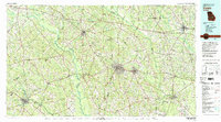
1979 Map of Vidalia
USGS Topo · Published 1980About this map
Vidalia and the surrounding agricultural heartland of southeast Georgia are defined here by a network of river systems and heavy rail infrastructure. The Oconee River and Ocmulgee River snake through the landscape, flanked by numerous tributaries like Pendleton Creek and Ochwalkee Creek. This 1970s survey captures the region's transport-driven development, featuring the intersection of the Seaboard Coast Line and Southern Railway, which served established municipal hubs from McRae and Helena in the west to Metter and Claxton in the east.
Find a feature on this map
144 named features on this map. Tap any name to fly to it.
Don’t see what you’re looking for? This feature index may not catch every label — zoom into the map to look around manually.
Map Details
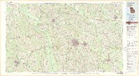
Editions of this 1979 Vidalia Map
2 editions found
Other maps of this area

1919 · Claxton
USGS Topo · 1:62,500

1920 · Statesboro
USGS Topo · 1:62,500

1920 · Glennville
USGS Topo · 1:62,500

1921 · Rocky Ford
USGS Topo · 1:62,500

1943 · Rocky Ford
USGS Topo · 1:62,500

1943 · Millen
USGS Topo · 1:125,000

1943 · Statesboro
USGS Topo · 1:62,500

1944 · Claxton
USGS Topo · 1:62,500

1944 · Glennville
USGS Topo · 1:62,500

1946 · Brunswick
USGS Topo · 1:250,000