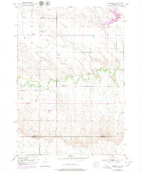
1953 Map of Viewfield
USGS Topo · Published 1979About this map
Elk Creek meanders through this portion of the Black Hills foothills, defining a landscape of high plateaus and carved drainage basins at the boundary of Meade and Pennington Counties. The rural character of the mid-20th century is preserved in the scattered placement of the Lost Nation Sch and Red Top Sch, indicating a sparse but established community of ranching families. The small settlement of Viewfield serves as the local anchor, supported by the nearby Viewfield Cem. Topographic revisions from the 1970s, shown in purple, reveal subtle shifts in the road network and land use while the primary terrain remains dominated by the erosion patterns of the creek and its tributaries. This survey serves as a vital record for genealogists researching families tied to these specific rural school districts and the small community at Viewfield before later development or consolidation.
Find a feature on this map
7 named features on this map. Tap any name to fly to it.
Don’t see what you’re looking for? This feature index may not catch every label — zoom into the map to look around manually.
Map Details
Editions of this 1953 Viewfield Map
2 editions found
Other maps of this area

1953 · Viewfield
USGS Topo · 1:24,000

1953 · Hereford SE
USGS Topo · 1:24,000

1953 · New Underwood
USGS Topo · 1:24,000

1953 · New Underwood SW
USGS Topo · 1:24,000

1953 · Hereford SW
USGS Topo · 1:24,000
1953 · New Underwood NW
USGS Topo · 1:24,000

1953 · Rapid City
USGS Topo · 1:250,000

1954 · Elm Springs SW
USGS Topo · 1:24,000

1957 · Rapid City
USGS Topo · 1:250,000
1957 · Owanka NW
USGS Topo · 1:24,000