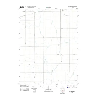
2012 Map of Villa Grove NW
USGS Topo · Published 2012About this map
The Embarras River and its various tributaries define the hydrology of this rural Champaign County landscape. Meandering through a grid of county roads, the river is joined by the E Br Embarras River, while significant drainage features like Black Slough, Long Point Slough, and Jordan Slough carve through the agricultural fields. The map reveals the placement of essential community landmarks including Saint Marys Cem and Jessee Cem, which serve as primary anchors for genealogical research in this part of Illinois. The transportation network is dominated by a systematic grid, including Co Hwy-600 and Washington St, facilitating movement across the prairie. This survey captures the region's enduring rural character and the persistent path of its waterways before modern development altered the drainage patterns.
Find a feature on this map
36 named features on this map. Tap any name to fly to it.
Don’t see what you’re looking for? This feature index may not catch every label — zoom into the map to look around manually.
Map Details
Editions of this 2012 Villa Grove NW Map
This is the sole edition of this map. No revisions or reprints were ever made.
Other maps of this area

1906 · Urbana
USGS Topo · 1:62,500

1907 · Mahomet
USGS Topo · 1:62,500

1950 · Tuscola
USGS Topo · 1:62,500

1956 · Villa Grove
USGS Topo · 1:62,500

1957 · Urbana
USGS Topo · 1:62,500

1957 · Urbana
USGS Topo · 1:24,000

1957 · Mahomet
USGS Topo · 1:62,500

1957 · Bondville
USGS Topo · 1:24,000

1958 · Peoria
USGS Topo · 1:250,000

1958 · Decatur
USGS Topo · 1:250,000