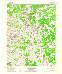
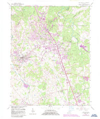
1960 Map of Vine Grove
USGS Topo · Published 1961About this map
Fort Knox Military Reservation dominates the northeastern portion of this landscape, its boundary cutting through the developing outskirts of Radcliff and Vine Grove Junction. The mid-century expansion of the military facility is evident, juxtaposed against the established agricultural and religious centers of Vine Grove and Rineyville. A network of family and community landmarks, such as St Brigids Sch and Stithton Cem, provides essential points for genealogical research within the Hardin Co countryside.
Find a feature on this map
60 named features on this map. Tap any name to fly to it.
Don’t see what you’re looking for? This feature index may not catch every label — zoom into the map to look around manually.
Map Details
Editions of this 1960 Vine Grove Map
5 editions found
Other maps of this area

1932 · Big Clifty
USGS Topo · 1:62,500

1935 · Elizabethtown
USGS Topo · 1:48,000

1936 · Vine Grove
USGS Topo · 1:62,500

1938 · Elizabethtown
USGS Topo · 1:62,500

1941 · Ekron
USGS Topo · 1:62,500

1943 · Vine Grove
USGS Topo · 1:62,500

1946 · Rock Haven
USGS Topo · 1:24,000

1946 · Pitts Point
USGS Topo · 1:24,000

1946 · Fort Knox
USGS Topo · 1:24,000

1946 · Colesburg
USGS Topo · 1:24,000