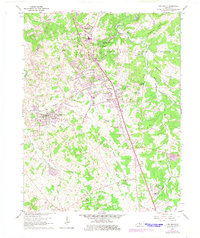
1960 Map of Vine Grove
USGS Topo · Published 1975About this map
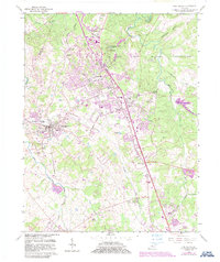
The Fort Knox Military Reservation dominates the northern and eastern portions of this landscape, creating a distinct boundary between the managed military terrain and the expanding residential corridors of Hardin County. The growth of Radcliff and Vine Grove is visible through numerous new subdivisions and trailer parks, reflecting the mid-century suburbanization tied to the nearby base. This development contrasts with the established agricultural patterns and the older rail infrastructure of the Illinois Central railroad, which runs through Vine Grove Junction and Rineyville.
Find a feature on this map
58 named features on this map. Tap any name to fly to it.
Don’t see what you’re looking for? This feature index may not catch every label — zoom into the map to look around manually.
Map Details
Editions of this 1960 Vine Grove Map
5 editions found
Other maps of this area

1932 · Big Clifty
USGS Topo · 1:62,500

1935 · Elizabethtown
USGS Topo · 1:48,000

1936 · Vine Grove
USGS Topo · 1:62,500

1938 · Elizabethtown
USGS Topo · 1:62,500

1941 · Ekron
USGS Topo · 1:62,500

1943 · Vine Grove
USGS Topo · 1:62,500

1946 · Rock Haven
USGS Topo · 1:24,000

1946 · Pitts Point
USGS Topo · 1:24,000

1946 · Fort Knox
USGS Topo · 1:24,000

1946 · Colesburg
USGS Topo · 1:24,000