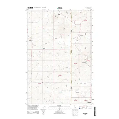
2013 Map of Viola
USGS Topo · Published 2013About this map
The Washington-Idaho state line bisects this landscape, dividing the agricultural plains of Whitman and Latah counties. This area is defined by the high ground of the Palouse Range and a series of prominent summits including Angel Butte, Ringo Butte, and Randall Butte. The settlement pattern is largely shaped by the winding courses of Fourmile Cr and Missouri Flat Cr, where small communities and namesake locales like Viola, Fallon, and Whelan are connected by a dense network of country roads like Mader Rd and Viola Rd. To the south, the map captures the northern edge of Moscow, showing the transition from the rolling hills of the Palouse into the urban periphery. Noted for its aviation history, the Hill Airport sits atop a rise near Sand Rd, illustrating the intersection of rural land use and small-scale transportation infrastructure in this border region.
Find a feature on this map
56 named features on this map. Tap any name to fly to it.
Don’t see what you’re looking for? This feature index may not catch every label — zoom into the map to look around manually.
Map Details
Editions of this 2013 Viola Map
This is the sole edition of this map. No revisions or reprints were ever made.
Other maps of this area

1910 · Pullman
USGS Topo · 1:125,000

1955 · Pullman
USGS Topo · 1:250,000

1958 · Pullman
USGS Topo · 1:250,000

1960 · Robinson Lake
USGS Topo · 1:24,000

1960 · Moscow East
USGS Topo · 1:24,000

1960 · Potlatch
USGS Topo · 1:62,500

1961 · Moscow
USGS Topo · 1:62,500

1964 · Viola
USGS Topo · 1:24,000

1964 · Elberton
USGS Topo · 1:24,000

1964 · Moscow West
USGS Topo · 1:24,000