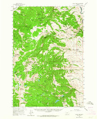
1958 Map of Vipond Park
USGS Topo · Published 1964About this map
Hecla Mines and the historic settlement of Glendale anchor this high-altitude survey of the Pioneer Mountains during the late 1950s. The map illustrates a complex legacy of hard-rock extraction, with dozens of workings like the Old Faithful Mine, Queen of the Hills Mine, and Sappington Mine dotting the drainages of Vipond Creek and Trapper Creek. The transition from industrial mining to forestry and ranching is evident in the presence of the Rock Creek Guard Sta and private holdings such as Siria Ranch and Spritzer Ranch. An Old Railroad Grade in the northwest corner traces an earlier era of transportation, while the interior is navigated by a network of primitive routes including the Pack Trail and Jeep Trail. High alpine basins are characterized by numerous small water bodies such as Tahepia Lake and Lake Agnes, situated beneath prominent summits like Gray Jockey Peak and Browns Peak.
Find a feature on this map
112 named features on this map. Tap any name to fly to it.
Don’t see what you’re looking for? This feature index may not catch every label — zoom into the map to look around manually.
Map Details
Editions of this 1958 Vipond Park Map
3 editions found
Other maps of this area

1893 · Dillon
USGS Topo · 1:250,000

1952 · Twin Adams Mountain
USGS Topo · 1:24,000

1952 · Torrey Mountain
USGS Topo · 1:24,000

1955 · Dillon
USGS Topo · 1:250,000

1957 · Dillon
USGS Topo · 1:250,000

1958 · Dillon
USGS Topo · 1:250,000

1958 · Vipond Park
USGS Topo · 1:62,500

1959 · Polaris
USGS Topo · 1:62,500

1960 · Glen
USGS Topo · 1:24,000

1961 · Melrose
USGS Topo · 1:24,000