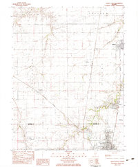
1983 Map of Virden North
USGS Topo · Published 1983About this map
The agricultural plains of the Sangamon and Macoupin county line are defined by a dense network of transit and small-town industry in this early 1980s provisional study. Virden and Auburn serve as the primary hubs, connected by a significant corridor of railroads including the Illinois Central Gulf and the Chicago and North Western. This era shows the region's coal mining heritage through the presence of a Mine Shaft near Thayer, while the landscape is dotted with private aviation markers like the McNaught Landing Strip and Weber Landing Strip. Drainage patterns from Sugar Creek and Panther Creek cut through the organized grid of townships such as Talkington and North Otter. Local genealogy is well-represented by the Virden Cem and West Cem, providing vital landmarks for family researchers in these prairie communities.
Find a feature on this map
30 named features on this map. Tap any name to fly to it.
Don’t see what you’re looking for? This feature index may not catch every label — zoom into the map to look around manually.
Map Details
Editions of this 1983 Virden North Map
This is the sole edition of this map. No revisions or reprints were ever made.
Other maps of this area

1922 · Divernon
USGS Topo · 1:62,500

1923 · Carlinville
USGS Topo · 1:48,000

1923 · Raymond
USGS Topo · 1:62,500

1924 · Divernon
USGS Topo · 1:62,500

1924 · Waverly
USGS Topo · 1:62,500

1925 · Carlinville
USGS Topo · 1:62,500

1925 · Raymond
USGS Topo · 1:62,500

1926 · Waverly
USGS Topo · 1:62,500

1931 · Carlinville
USGS Topo · 1:62,500

1958 · Decatur
USGS Topo · 1:250,000