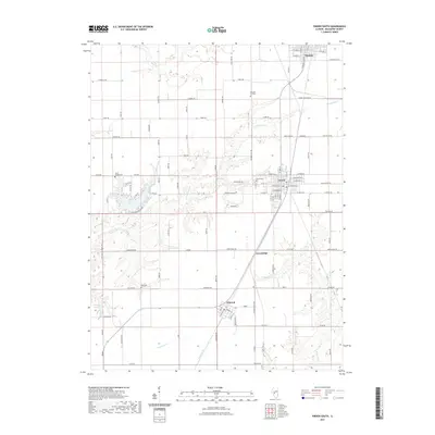
2021 Map of Virden South
USGS Topo · Published 2021About this map
The agrarian landscape of northern Macoupin County is anchored by the long-standing communities of Virden and Girard, which sit atop the prairie along the historical corridor of Old Rte 4. This 2021 update shows the modern evolution of these settlements, where the geometric precision of county roads like Thomasville Rd and Greenridge Rd meets the irregular, branching drainages of E Fork Otter Cr and Sugar Cr. The map preserves important genealogical landmarks, including Pleasant Hill Cem and Ross Cem, which mark the early burial grounds of local families. Evidence of the region’s industrial history is found in labels like Crown Two Mine Rd, reflecting the coal mining operations that once drove the local economy alongside the small railway settlements of Nilwood and Greenridge.
Find a feature on this map
84 named features on this map. Tap any name to fly to it.
Don’t see what you’re looking for? This feature index may not catch every label — zoom into the map to look around manually.
Map Details
Editions of this 2021 Virden South Map
This is the sole edition of this map. No revisions or reprints were ever made.
Other maps of this area

1922 · Divernon
USGS Topo · 1:62,500

1923 · Carlinville
USGS Topo · 1:48,000

1923 · Raymond
USGS Topo · 1:62,500

1924 · Divernon
USGS Topo · 1:62,500

1924 · Waverly
USGS Topo · 1:62,500

1925 · Carlinville
USGS Topo · 1:62,500

1925 · Raymond
USGS Topo · 1:62,500

1926 · Waverly
USGS Topo · 1:62,500

1931 · Carlinville
USGS Topo · 1:62,500

1958 · Decatur
USGS Topo · 1:250,000