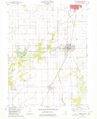
1979 Map of Virden South
USGS Topo · Published 1980About this map
Girard and Virden anchor the northern reaches of this Macoupin County landscape, where the agricultural grid meets an intricate network of competing railroads. The Burlington Northern, Gulf Central Illinois, and Chicago and North Western lines intersect these prairie towns, illustrating a late-20th-century transport hub. Near the western border, the Sunset Lake reservoir stands out with its Spillway and Intake, carved into the drainage of the East Fork of Otter Creek.
Find a feature on this map
32 named features on this map. Tap any name to fly to it.
Don’t see what you’re looking for? This feature index may not catch every label — zoom into the map to look around manually.
Map Details
Editions of this 1979 Virden South Map
This is the sole edition of this map. No revisions or reprints were ever made.
Other maps of this area

1922 · Divernon
USGS Topo · 1:62,500

1923 · Carlinville
USGS Topo · 1:48,000

1923 · Raymond
USGS Topo · 1:62,500

1924 · Divernon
USGS Topo · 1:62,500

1924 · Waverly
USGS Topo · 1:62,500

1925 · Carlinville
USGS Topo · 1:62,500

1925 · Raymond
USGS Topo · 1:62,500

1926 · Waverly
USGS Topo · 1:62,500

1931 · Carlinville
USGS Topo · 1:62,500

1958 · Decatur
USGS Topo · 1:250,000