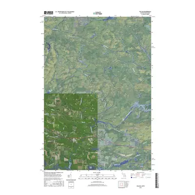
2017 Map of Vulcan
USGS Topo · Published 2017About this map
Sturgeon River hydraulics and Upper Peninsula timberlands define this 2017 landscape in Dickinson County. The settlements of Vulcan and Loretto sit along the southern rail corridor, positioned near water sources that historically drove local development. The river's path is marked by Power Dam Falls, indicating the long-standing industrial reliance on regional waterways. To the south, a cluster of named water bodies including Hamilton Lake, Mary Lake, and Louise Lake suggests a shift toward the recreational use of the land.
Find a feature on this map
54 named features on this map. Tap any name to fly to it.
Don’t see what you’re looking for? This feature index may not catch every label — zoom into the map to look around manually.
Map Details
Editions of this 2017 Vulcan Map
This is the sole edition of this map. No revisions or reprints were ever made.
Other maps of this area

1939 · Pembine
USGS Topo · 1:48,000

1947 · Pembine
USGS Topo · 1:48,000

1954 · Escanaba
USGS Topo · 1:250,000

1955 · Norway
USGS Topo · 1:24,000

1955 · Vulcan
USGS Topo · 1:24,000

1955 · Norway
USGS Topo · 1:62,500

1956 · Foster City
USGS Topo · 1:62,500

1957 · Escanaba
USGS Topo · 1:250,000

1958 · Escanaba
USGS Topo · 1:250,000

1963 · Pembine
USGS Topo · 1:62,500