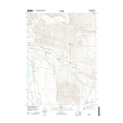
2015 Map of Wacker
USGS Topo · Published 2015About this map
Plum River and its intricate tributaries, including Carroll Cr and Camp Cr, define the drainage patterns of this Carroll County landscape. The area is characterized by a network of rural settlements and named crossroads, from the edge of Savanna in the northwest to Argo Fay in the southeast. A clear corridor of human activity follows Wacker Road, connecting the communities of Hickory Grove, Wacker, and Burke.
Find a feature on this map
64 named features on this map. Tap any name to fly to it.
Don’t see what you’re looking for? This feature index may not catch every label — zoom into the map to look around manually.
Map Details
Editions of this 2015 Wacker Map
This is the sole edition of this map. No revisions or reprints were ever made.
Other maps of this area

1891 · Clinton
USGS Topo · 1:62,500

1892 · Savanna
USGS Topo · 1:62,500

1894 · Clinton
USGS Topo · 1:62,500

1899 · Clinton
USGS Topo · 1:125,000

1934 · Morrison
USGS Topo · 1:48,000

1940 · Morrison
USGS Topo · 1:62,500

1942 · Mt Carroll
USGS Topo · 1:62,500

1944 · Mt Carroll
USGS Topo · 1:62,500

1952 · Clinton
USGS Topo · 1:62,500

1952 · Savanna
USGS Topo · 1:62,500