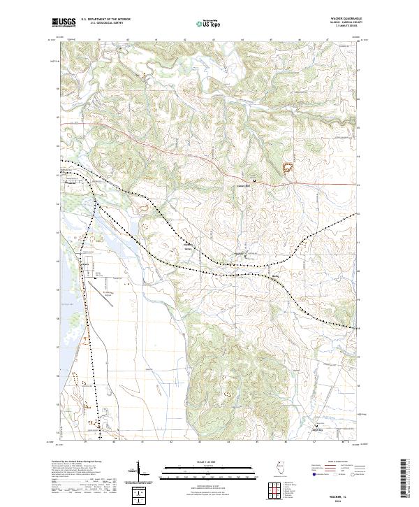
2024 Map of Wacker
USGS Topo · Published 2024About this map
Upper Mississippi River National Wildlife and Fish Refuge defines the western edge of this landscape, where the alluvial bottoms meet the higher ground of central Carroll County. This modern survey illustrates the enduring rural character of settlements like Hickory Grove, Wacker, and Argo Fay, which remain centered on a network of winding county roads such as Scenic Bluff Rd and Fulrath Mill Rd. The map tracks the drainages of Plum River and Carroll Creek as they cut through the terrain toward the Mississippi floodplain. Genealogists will find several key burial sites documented, including Center Hill Cem, Wacker Cem, and Spring Lake Cem. Near the town of Savanna, the Tri-Township Airport and Spring Lake provide modern landmarks alongside the established residential streets and rural corridors that have shaped this portion of Illinois for generations.
Find a feature on this map
62 named features on this map. Tap any name to fly to it.
Don’t see what you’re looking for? This feature index may not catch every label — zoom into the map to look around manually.
Map Details
Editions of this 2024 Wacker Map
This is the sole edition of this map. No revisions or reprints were ever made.
Other maps of this area

1891 · Clinton
USGS Topo · 1:62,500

1892 · Savanna
USGS Topo · 1:62,500

1894 · Clinton
USGS Topo · 1:62,500

1899 · Clinton
USGS Topo · 1:125,000

1934 · Morrison
USGS Topo · 1:48,000

1940 · Morrison
USGS Topo · 1:62,500

1942 · Mt Carroll
USGS Topo · 1:62,500

1944 · Mt Carroll
USGS Topo · 1:62,500

1952 · Clinton
USGS Topo · 1:62,500

1952 · Savanna
USGS Topo · 1:62,500