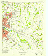
1957 Map of Waco East
USGS Topo · Published 1958About this map
Baylor University and the historic heart of Waco anchor this mid-century landscape, where the Brazos River divides the city from its expanding eastern neighborhoods. The riverbank is heavily modified by an extensive levee system and numerous gravel pits, reflecting a period of intense infrastructure development and industrial use. To the north, James Connally Air Force Base and the Warden Locomotive Shop highlight the area's strategic importance for transportation and defense. The map serves as a detailed record of local educational and religious institutions during a time of segregation and growth, showing schools like Moore High Sch, Paul Quinn College, and La Vega High Sch alongside neighborhood landmarks such as St Josephs Ch and Oakwood Cemetery. The dense network of railroads, including the Missouri Pacific and Texas and New Orleans, illustrates how the rail-and-river economy continued to shape the city's physical form.
Find a feature on this map
80 named features on this map. Tap any name to fly to it.
Don’t see what you’re looking for? This feature index may not catch every label — zoom into the map to look around manually.
Map Details
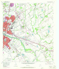
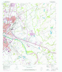
Editions of this 1957 Waco East Map
3 editions found
Other maps of this area

1892 · Temple
USGS Topo · 1:125,000

1892 · Waco
USGS Topo · 1:125,000

1920 · Waco
USGS Topo · 1:125,000

1920 · Mart
USGS Topo · 1:62,500

1924 · Waco 4-c
USGS Topo · 1:48,000

1931 · Elm Mott
USGS Topo · 1:62,500

1954 · Waco
USGS Topo · 1:250,000

1955 · Waco
USGS Topo · 1:250,000

1956 · Axtell
USGS Topo · 1:24,000
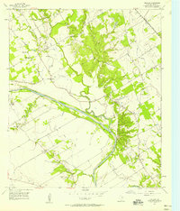
1957 · Gholson
USGS Topo · 1:24,000