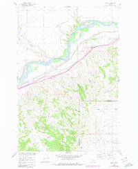
1960 Map of Waco
USGS Topo · Published 1980About this map
The Yellowstone River cuts a wide path through the northern half of this landscape, flanked by the broad Seven Mile Flat. The infrastructure of the Northern Pacific railroad and the Northern Pacific Canal follows the river valley, supporting the small siding at Waco and the nearby station at Fee. These transportation and irrigation corridors illustrate the early 20th-century development patterns of the Montana plains, where water access and rail connectivity dictated the survival of rural settlements.
Find a feature on this map
21 named features on this map. Tap any name to fly to it.
Don’t see what you’re looking for? This feature index may not catch every label — zoom into the map to look around manually.
Map Details
Editions of this 1960 Waco Map
2 editions found

Other maps of this area

1894 · Fort Custer
USGS Topo · 1:125,000

1954 · Hardin
USGS Topo · 1:250,000

1954 · Forsyth
USGS Topo · 1:250,000

1957 · Hardin
USGS Topo · 1:250,000

1957 · Forsyth
USGS Topo · 1:250,000

1958 · Forsyth
USGS Topo · 1:250,000

1958 · Hardin
USGS Topo · 1:250,000

1960 · Foster
USGS Topo · 1:24,000

1960 · Coal Bank Creek
USGS Topo · 1:24,000

1960 · Custer
USGS Topo · 1:24,000