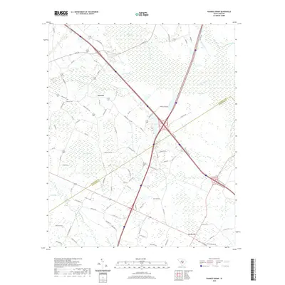
2020 Map of Wadboo Swamp
USGS Topo · Published 2020About this map
Wadboo Swamp and Indian Field Swamp dominate this Lowcountry landscape along the border of Orangeburg and Dorchester counties. The map details a rural transition zone where traditional South Carolina swamp drainage systems meet a modern transportation network. Small communities like Whetsell and Rosinville are connected by a web of local routes including Ebenezer Rd and Duncan Chapel Rd, reflecting late-century settlement patterns and road development.
Find a feature on this map
77 named features on this map. Tap any name to fly to it.
Don’t see what you’re looking for? This feature index may not catch every label — zoom into the map to look around manually.
Map Details
Editions of this 2020 Wadboo Swamp Map
This is the sole edition of this map. No revisions or reprints were ever made.
Other maps of this area

1919 · Ridgeville
USGS Topo · 1:48,000

1920 · Eutawville
USGS Topo · 1:48,000

1920 · Bowman
USGS Topo · 1:48,000

1920 · Ridgeville
USGS Topo · 1:62,500

1920 · St. George
USGS Topo · 1:48,000

1921 · Bowman
USGS Topo · 1:62,500

1921 · St. George
USGS Topo · 1:62,500

1921 · Eutawville
USGS Topo · 1:62,500

1943 · Bowman
USGS Topo · 1:62,500

1943 · Orangeburg
USGS Topo · 1:125,000