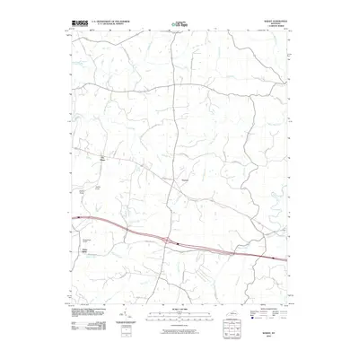
2010 Map of Waddy
USGS Topo · Published 2010About this map
Jeptha Knob dominates the landscape of this central Kentucky region, standing as a prominent geological landmark southeast of Clay Village. The settlement patterns here follow the winding courses of numerous waterways, including Tick Creek, Guist Creek, and White Oak Creek, which carve through the undulating terrain. Small rural communities like Peytona and Hemp Ridge are connected by a network of established routes such as the Bardstown Trl and Peytona Beach Rd. The map also captures local infrastructure like the Hemp Ridge Airport and many family-named roads, including Harley-Thompson Rd and Bob Rodgers Rd, which provide valuable clues for genealogical research and understanding the land ownership and development of Shelby County in the early 21st century.
Find a feature on this map
44 named features on this map. Tap any name to fly to it.
Don’t see what you’re looking for? This feature index may not catch every label — zoom into the map to look around manually.
Map Details
Editions of this 2010 Waddy Map
This is the sole edition of this map. No revisions or reprints were ever made.
Other maps of this area

1906 · Lockport
USGS Topo · 1:48,000

1908 · Lockport
USGS Topo · 1:62,500

1922 · Frankfort
USGS Topo · 1:48,000

1923 · Waddy
USGS Topo · 1:48,000

1924 · Frankfort
USGS Topo · 1:62,500

1925 · Mount Eden
USGS Topo · 1:48,000

1927 · Mount Eden
USGS Topo · 1:62,500

1928 · New Castle
USGS Topo · 1:48,000

1932 · New Castle
USGS Topo · 1:62,500

1951 · Lawrenceburg
USGS Topo · 1:24,000