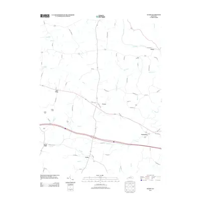
2013 Map of Waddy
USGS Topo · Published 2013About this map
Jeptha Knob rises as a prominent landmark in this section of Shelby County, overlooking a landscape defined by small crossroads settlements and winding watercourses. This 2013 survey records the rural layout of communities such as Clay Village, Peytona, and Waddy, where local life is oriented around historically significant road networks. The northern portion of the map is shaped by the Guist Creek Lake and the drainage of Dutch Fork, while the southern reaches are marked by the presence of Hemp Ridge and Graefenburg.
Find a feature on this map
63 named features on this map. Tap any name to fly to it.
Don’t see what you’re looking for? This feature index may not catch every label — zoom into the map to look around manually.
Map Details
Editions of this 2013 Waddy Map
This is the sole edition of this map. No revisions or reprints were ever made.
Other maps of this area

1906 · Lockport
USGS Topo · 1:48,000

1908 · Lockport
USGS Topo · 1:62,500

1922 · Frankfort
USGS Topo · 1:48,000

1923 · Waddy
USGS Topo · 1:48,000

1924 · Frankfort
USGS Topo · 1:62,500

1925 · Mount Eden
USGS Topo · 1:48,000

1927 · Mount Eden
USGS Topo · 1:62,500

1928 · New Castle
USGS Topo · 1:48,000

1932 · New Castle
USGS Topo · 1:62,500

1951 · Lawrenceburg
USGS Topo · 1:24,000