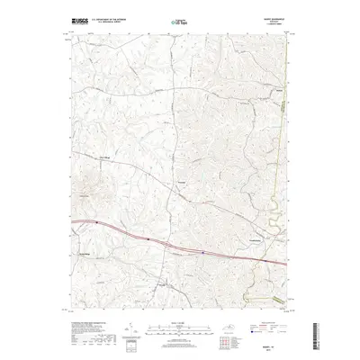
2019 Map of Waddy
USGS Topo · Published 2019About this map
Jeptha Knob anchors the western portion of this Shelby County landscape, rising prominently above the surrounding drainages of Jeptha Cr and Wolf Run. The area is characterized by a network of small rural settlements including Clay Village, Peytona, and Graefenburg, all linked by the historic corridor of Frankfort Rd. Near the eastern boundary with Franklin County, the community of Hatton sits amidst a web of family-named routes such as Quisenberry Ln and Grover Blaides Rd. The southern reach of the quadrangle includes Waddy and Hemp Ridge, where the terrain begins to slope toward the Bold Run and Waddy Br waterways. This survey also records important local landmarks for genealogists, such as the Beech Ridge Cem located off Beechridge Rd, providing a clear look at the spatial relationship between these crossroads communities and the rolling hills of the Bluegrass region.
Find a feature on this map
68 named features on this map. Tap any name to fly to it.
Don’t see what you’re looking for? This feature index may not catch every label — zoom into the map to look around manually.
Map Details
Editions of this 2019 Waddy Map
This is the sole edition of this map. No revisions or reprints were ever made.
Other maps of this area

1906 · Lockport
USGS Topo · 1:48,000

1908 · Lockport
USGS Topo · 1:62,500

1922 · Frankfort
USGS Topo · 1:48,000

1923 · Waddy
USGS Topo · 1:48,000

1924 · Frankfort
USGS Topo · 1:62,500

1925 · Mount Eden
USGS Topo · 1:48,000

1927 · Mount Eden
USGS Topo · 1:62,500

1928 · New Castle
USGS Topo · 1:48,000

1932 · New Castle
USGS Topo · 1:62,500

1951 · Lawrenceburg
USGS Topo · 1:24,000