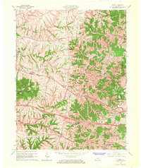
1965 Map of Waddy
USGS Topo · Published 1967About this map
The Southern railroad corridor serves as the industrial spine for this mid-1960s landscape, connecting the village of Waddy to the surrounding agricultural uplands. The terrain is defined by a dense network of drainage runs, including Wolf Run, Jeptha Run, and McCormack Run, which carve through the ridges toward Benson Creek. The topography is particularly distinctive near Jeptha Knob and Hemp Ridge, where the elevation rises sharply above the creek beds.
Find a feature on this map
32 named features on this map. Tap any name to fly to it.
Don’t see what you’re looking for? This feature index may not catch every label — zoom into the map to look around manually.
Map Details
Editions of this 1965 Waddy Map
4 editions found
Other maps of this area

1906 · Lockport
USGS Topo · 1:48,000

1908 · Lockport
USGS Topo · 1:62,500

1922 · Frankfort
USGS Topo · 1:48,000

1923 · Waddy
USGS Topo · 1:48,000

1924 · Frankfort
USGS Topo · 1:62,500

1925 · Mount Eden
USGS Topo · 1:48,000

1927 · Mount Eden
USGS Topo · 1:62,500

1928 · New Castle
USGS Topo · 1:48,000

1932 · New Castle
USGS Topo · 1:62,500

1951 · Lawrenceburg
USGS Topo · 1:24,000