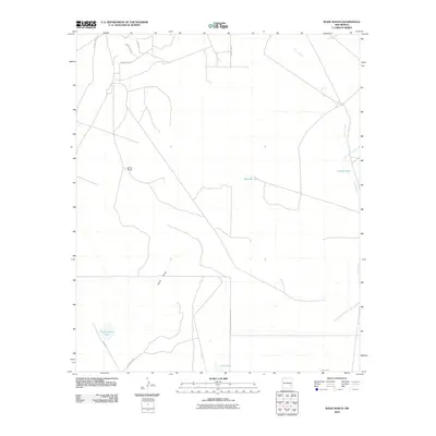
2010 Map of Wade Ranch
USGS Topo · Published 2010About this map
Wade Ranch serves as a primary landmark in this Chaves County landscape, where the Chihuahuan Desert environment is defined by its water management and drainage patterns. The topography is shaped by the winding course of Long Arroyo and its East Fork, which collect runoff alongside features like Sand Draw. Strategic water points such as Camps Tank and Mesquite Tank reflect the necessities of ranching in this arid New Mexico region.
Find a feature on this map
17 named features on this map. Tap any name to fly to it.
Don’t see what you’re looking for? This feature index may not catch every label — zoom into the map to look around manually.
Map Details
Editions of this 2010 Wade Ranch Map
This is the sole edition of this map. No revisions or reprints were ever made.
Other maps of this area

1949 · Sardine Mountain
USGS Topo · 1:24,000

1949 · Wade Ranch
USGS Topo · 1:24,000

1949 · Malstrom Ranch
USGS Topo · 1:24,000

1949 · L-E Ranch
USGS Topo · 1:24,000

1950 · Comanche Spring
USGS Topo · 1:24,000

1950 · Bottomless Lakes
USGS Topo · 1:24,000

1950 · Dexter East
USGS Topo · 1:24,000

1952 · Connor Well
USGS Topo · 1:24,000

1952 · Bar C Bar Ranch
USGS Topo · 1:24,000

1955 · Roswell
USGS Topo · 1:250,000