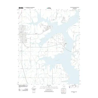
2012 Map of Wagoner East
USGS Topo · Published 2012About this map
Wagoner anchors the western edge of this landscape, where the street grid of the city meets the sprawling aquatic fingers of the Fitzgerald-Soldier Cr Site 1 Reservoir. This 2012 survey illustrates the significant impact of water management on the local geography, with former creek beds like Battle Cr and Miller Cr now forming deep inlets of the reservoir. The settlement pattern is largely defined by these shorelines, as seen in the lakeside communities of Toppers and Taylor Ferry.
Find a feature on this map
105 named features on this map. Tap any name to fly to it.
Don’t see what you’re looking for? This feature index may not catch every label — zoom into the map to look around manually.
Map Details
Editions of this 2012 Wagoner East Map
This is the sole edition of this map. No revisions or reprints were ever made.
Other maps of this area

1896 · Pryor
USGS Topo · 1:125,000

1901 · Muscogee
USGS Topo · 1:125,000

1901 · Pryor
USGS Topo · 1:125,000

1905 · Muscogee
USGS Topo · 1:125,000

1946 · Fort Smith
USGS Topo · 1:250,000

1948 · Hulbert
USGS Topo · 1:62,500

1948 · Wagoner
USGS Topo · 1:62,500

1950 · Wagoner
USGS Topo · 1:62,500

1950 · Hulbert
USGS Topo · 1:62,500

1954 · Tulsa
USGS Topo · 1:250,000