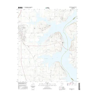
2016 Map of Wagoner East
USGS Topo · Published 2016About this map
The eastern reaches of Wagoner and the sprawling waters of Fort Gibson Lake define this area of northeastern Oklahoma. The lake’s irregular shoreline is marked by numerous indentations, including North Bay, Long Bay, Jackson Bay, and Wahoo Bay, while residential clusters like Toppers and Taylor Ferry occupy the peninsulas between them. To the west, the city of Wagoner extends its grid of streets such as N Gertrude Ave and SE 15th St toward the water, reflecting the community’s growth around the reservoir's recreational and hydrological landscape.
Find a feature on this map
103 named features on this map. Tap any name to fly to it.
Don’t see what you’re looking for? This feature index may not catch every label — zoom into the map to look around manually.
Map Details
Editions of this 2016 Wagoner East Map
This is the sole edition of this map. No revisions or reprints were ever made.
Other maps of this area

1896 · Pryor
USGS Topo · 1:125,000

1901 · Muscogee
USGS Topo · 1:125,000

1901 · Pryor
USGS Topo · 1:125,000

1905 · Muscogee
USGS Topo · 1:125,000

1946 · Fort Smith
USGS Topo · 1:250,000

1948 · Hulbert
USGS Topo · 1:62,500

1948 · Wagoner
USGS Topo · 1:62,500

1950 · Wagoner
USGS Topo · 1:62,500

1950 · Hulbert
USGS Topo · 1:62,500

1954 · Tulsa
USGS Topo · 1:250,000