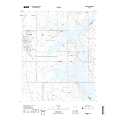
2018 Map of Wagoner East
USGS Topo · Published 2018About this map
Fort Gibson Lake dominates this landscape, its irregular shoreline creating a complex network of inlets and peninsulas that define local geography. The eastern edge of Wagoner is represented with its dense grid of streets, including residential corridors like NE 13th St and E Cherokee St. Small settlements like Toppers and Taylor Ferry are situated along the lake's fingers, serving as gateways to the water. The presence of both Hefner-Easley Airport and Whitehorn Cove Airport suggests the importance of aviation in this region of Oklahoma. For those tracing family ties to the area, the map preserves the locations of Pioneer Memorial Cem and Ray Cem, which remain as fixed points amidst the modern development and the expansive waters of North Bay and Jackson Bay.
Find a feature on this map
91 named features on this map. Tap any name to fly to it.
Don’t see what you’re looking for? This feature index may not catch every label — zoom into the map to look around manually.
Map Details
Editions of this 2018 Wagoner East Map
This is the sole edition of this map. No revisions or reprints were ever made.
Other maps of this area

1896 · Pryor
USGS Topo · 1:125,000

1901 · Muscogee
USGS Topo · 1:125,000

1901 · Pryor
USGS Topo · 1:125,000

1905 · Muscogee
USGS Topo · 1:125,000

1946 · Fort Smith
USGS Topo · 1:250,000

1948 · Hulbert
USGS Topo · 1:62,500

1948 · Wagoner
USGS Topo · 1:62,500

1950 · Wagoner
USGS Topo · 1:62,500

1950 · Hulbert
USGS Topo · 1:62,500

1954 · Tulsa
USGS Topo · 1:250,000