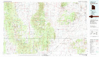
1980 Map of Wah Wah Mts. South
USGS Topo · Published 1984About this map
The Wah Wah Mountains and the arid Escalante Desert dominate this 1980 survey, revealing a landscape defined by 19th-century silver mining and the critical path of the Union Pacific railroad. The settlement of Milford serves as the regional anchor, while the surrounding hills are peppered with evidence of a booming mineral past. Most notable is Frisco (Ghost Town), once a major mining hub, located near the famed Horn Silver Mine. Other historic operations such as the Carbonate Mine, Utah Mine, and Magnolia Mine illustrate the intense geological exploitation of the Shauntie Hills and Black Mountains. The rail corridor through the desert connects small siding locations like Thermo, Lund, and Latimer, which supported transportation across the basin. From the high elevations of Badger Peak to the broad expanse of Pine Valley, the map captures the transition between high desert ranges and the infrastructure that once fueled Utah’s mining industry.
Find a feature on this map
78 named features on this map. Tap any name to fly to it.
Don’t see what you’re looking for? This feature index may not catch every label — zoom into the map to look around manually.
Map Details
Editions of this 1980 Wah Wah Mts. South Map
2 editions found

Other maps of this area

1885 · St. George
USGS Topo · 1:250,000

1885 · Beaver
USGS Topo · 1:250,000

1885 · Pioche
USGS Topo · 1:250,000

1886 · Kanab
USGS Topo · 1:250,000

1886 · Pioche
USGS Topo · 1:250,000

1891 · St. George
USGS Topo · 1:250,000

1950 · Enoch
USGS Topo · 1:62,500

1950 · Enoch NE
USGS Topo · 1:24,000

1951 · Avon
USGS Topo · 1:24,000

1951 · Avon NW
USGS Topo · 1:24,000