
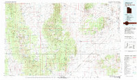
1980 Map of Wah Wah Mts. South
USGS Topo · Published 1984About this map
Mining operations and remote desert outposts define this western Utah landscape, where the Wah Wah Mountains and Needles Range rise from the arid floor of the Escalante Desert. Compiled from surveys spanning the mid-20th century, the map documents the concentration of mineral extraction in the Shauntie Hills and north of the Black Mountains, featuring sites like the Copper King Mine and Velvet Silver Mine. The industrial footprint is further evidenced by the Union Pacific Railroad corridor, which connects small settlements like Lund and Milford to the wider region.
Find a feature on this map
94 named features on this map. Tap any name to fly to it.
Don’t see what you’re looking for? This feature index may not catch every label — zoom into the map to look around manually.
Map Details
Editions of this 1980 Wah Wah Mts. South Map
2 editions found
Other maps of this area

1885 · St. George
USGS Topo · 1:250,000

1885 · Beaver
USGS Topo · 1:250,000

1885 · Pioche
USGS Topo · 1:250,000

1886 · Kanab
USGS Topo · 1:250,000

1886 · Pioche
USGS Topo · 1:250,000

1891 · St. George
USGS Topo · 1:250,000

1950 · Enoch
USGS Topo · 1:62,500

1950 · Enoch NE
USGS Topo · 1:24,000

1951 · Avon
USGS Topo · 1:24,000

1951 · Avon NW
USGS Topo · 1:24,000